A continuation of a trip which started on Sept 10th. after time spent in the UK. (here)
Bonifacio - 9/24-25 (here)
Sarten- Filitosa, Ajaccio, Piana. 9/26-27 (here)

The road between Piana (where we spent the previous night) and Porto Ota along the stunning Calanches, is one of the most beautiful drives in Europe. Although it took only less then half an hour, the drive on the narrow serpentine road, in-between the looming stunning red cliffs, is definitely challenging,

Amazing red pointy cliffs, looming rock formations and bulging stones, at one end, and deep drops at the other, from high altitude against the backdrop of the sea

The View of Porto from the Meandering Road Above

Porto is in quite a remote location but it is in the center of the most scenic highlights
Porto is part of the commune of Ota, a village in the mountains a few km east of Porto

The small community of Porto Ota of about 600 inhabitants is nestled at the bottom of a lush valley that is surrounded by impressive cliffs and rock formations on the magnificent Gulf of Porto, which has been a UNESCO World Heritage Site since 2006.

Porto barely existed 50 years ago and has done its best to cater to the ever increasing numbers of tourists that, like us, are drawn to this part of Corsica,
in summer, apparently the roads and town can be very congested. thus the visit off season, at the end of Sep, made the experience much more pleasant

Porto is largely a long row of hotels, apartments, few restaurants and Cafes that have been built along the river valley.

At the end of the headland there is an ancient tower, built by the Genoese in the 16th c. There is a small charge to pay to enter the tower (which also allows access to a small museum explaining the history of Corsica), A walk out along the headland offers great views from the top of the tower, both out to sea and back across the village,

The Calanches and the coastline here are absolutely breathtaking.

The Rocky Bay on which the sea waves and weather shape the rugged landscape

Behind Porto's hotels, the pretty Porto river valley and the looming tall mountains create a spectacular backdrop also to the nature reserve of Girolata, and the Scandola Nature Reserve
Back to Bonifacio via Corte

On the way off the Porto coast, toward East on D84, and back South to Bonifaccio
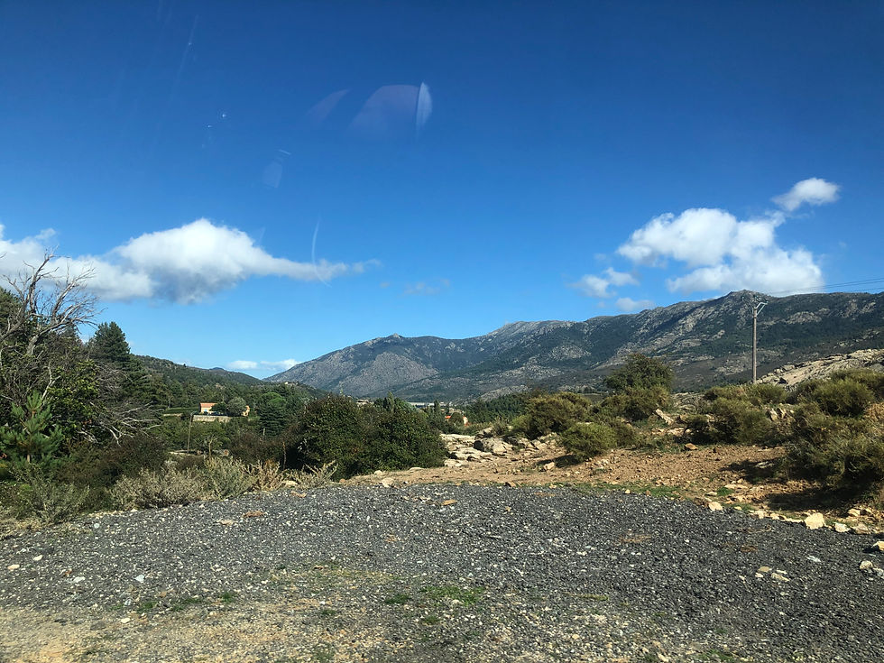
via Corte the drive into the interior of the island, proceeds through a densely forested very high altitude landscape,
Only 3 km inland, the mountains already reach an altitude of 1’000m.

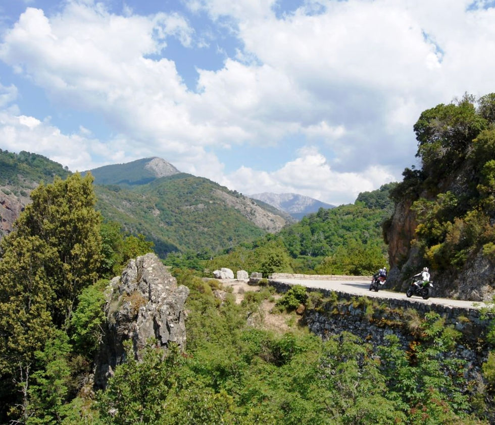
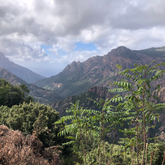
The very narrow meandering long ride, passes through deep canyons, mountain picks, passes and bridges, over running rivers with big boulders, pools and dams.

The first 20 km of the route between the villages of Ota and Evisa travels through the Gorges de Spelunca, a scenic river valley, which runs through the mountains, and is one of the highlights.
The Spelunca river runs through the gorge between great boulders and pools

A stone arched bridge has a a 'single-arch' design and was carefully constructed to withstand the occasional water torrents that pass through the gorge
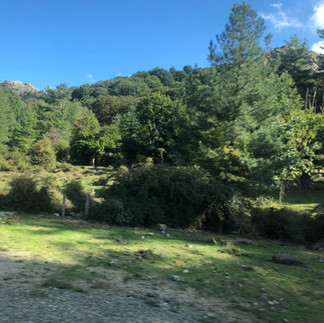
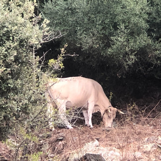
The huge Pine forests of the stunning mountainous country side is an unexpected habitat for the free roaming cows, goats and and large groups of wild pigs and piglets
So driving can be challenging not only because of the serpentine road through the high altitude, but also due to unforeseen encounters, with the toad crossings of nature's creatures .

The picturesque hill village at the upper end of the Gorges de Spelunca is situated about 10km inland from Porto, and is surrounded by forests and mountains. offering hiking opportunities in the surrounding scenery

Calacuccia is situated in the heart of the highest valley on the island. surrounded by a magnificent ring of mountains, cloaked in greenery.
The shops in this village situated in the center of the valley on the shores of a man-made lake/ a reservoir

The Lac de Calacuccia which is situated at an altitude of 793m. was created by the construction of a dam across the Golo river.
It provides hydroelectric power and water for irrigation in the dry season.
The views of the area are absolutely stunning, and probably to truly experience this amazing landscape,
more staying time is needs to be planned
for nature walks, which we sadly didn't have, as we were only driving through.
The Man-Made lake

The Dam over the Golo River

The drive to Corte is over the island’s highest mountain pass – at 1,477m.
Vergio Pass at Vergio Pass road also known as Bocca à Verghju, and consists of dramatic sections just below halfway up on both sides. The pass is the highest point of the D84 road.
After descending the pass, there was a stretch of road through Restonica Gorge

Restonica Gorge is a popular hiking, climbing and swimming destination,near Corte. The Restonica river that flows through the gorge, springs at Lake Melo, at 1,710 m above sea level, and flows down until it joins the Tavignano river in the south. Along the river, there are natural pools popular with bathers in the summer who want to cool off.
Finally after driving almost 3 hours through the mountainous enchanting landscape, we arrived to this ancient capital of Corsica, which is home also to Corsica’s only University, and which about 30% of its residents are students.

Corte - the central city of Corsica, is the mountain city and considered the heart of the island. It has a long and rich history. and distinct cultural heritage .
It is positioned at the confluence of 2 great rivers, Restonica and Tavignano. and at the crosswords of ancient routes.

The old town was the capital of the island from 1755-1769 under Pasquale Paoli.
the leader of independent Corsica in the mid 18th c , He was a Corsican patriot, statesman, and military leader who was at the forefront of resistance movements against the Genoese and later French rule over the island.
.
Corte has been classified as a Napoleonic town since 2015, as Napoleaon Bonaparte, who was born in nearby Ajaccio, spent various holidays here. and he often met Paoli

Overlooking the town, on a steep 400m high rocky spur looms the forbidding 15th C Citadel (now a museum) which dominates the beautiful landscapes of the interior.

Corte attracts visitors because of its proximity to many natural wonders, Gorges of Restonica, Tavignano Valley, The Asco Valley, Monte Cinto (Corsica’s highest mountain),
The winding narrow roads, nature trails and tracks offer a jaw-dropping views and attracts bicyclers, bikers and hikers
The drive through the mountains was strenuous and long, but the spectacular views were well worth distraction.

It took additional over 2 hours to drive South on T10 from Corte to Benefacio, where we spent the last night in Corsica, prior to continuing to Sardinia.

One other quint beach village passed on the way down south was the village of Favone, situated on the Coast(Rib) of Mother-of-pearls between Saint Lucia of Porto Vecchio and Solenzara.
Favone Conca - beach stretches for about 500 meters and has fine golden sand ..
And further down South on the way to Benifacio , we passed through Porto Vecchio
Porto Vecchio - La Cité du Sel


Although not the most captivating nor prominent of Corsica’s towns, this Southeast old,medium-sized port/ seaside town, is perched on a rocky hill, overlooking a beautiful bay of the Tyrrhenian Sea, providing dramatic views of the surrounding seascapes.

Less then 30 minutes drive north of Boneficio, the town is surrounded by vast marchlands dotted by pink-fathered flamingos, and is predominantly known for its exquisite exotic-looking beaches, fashionable marina, historical salt production and a well-preserved Citadel, The walls of a 16th-ceGenoese citadel are the backdrop to the old town and offer views over the yacht-filled marina..
Nearby, renowned beaches include Palombaggia, its stretch of sand lined with pine trees, and lagoon-like Santa Giulia.


Our last night in Bonifacio, before taking off to Sardinia, was spent at the old thcenter at the upper town, sleeping in the very modest Hotel Le Royal, that can only vouch for its charming location and friendly staff, but not much else.
Summary of the Corsica Experience
Our experience of touring this rugged French Island was very mixed.
Most of the mountainous terrain is dissolute, yet lush green,with dramatic pointy
cliffs and rocky huge boulders.
It is hardly cultivated and here and there are vineyards in less steep hilly landscape
Fast HWY infrastructure is not that developed, thus the driving especially from East to West is on very narrow serpentine roads, is time consuming and is very strenuous.
However the vistas of high pass cliffs, deep canyons, water bodies, forested reservation and other natural landscapes of rocky coast line and elongated bays are stunning.
The beaches can be beautiful but not easily accessible.
Food is good but very expensive, considering it is not a top notch. destination,
So are hotel prices, which most are just OK, as are prices of Taxi rides.
As tourist we felt being taken advantage And the local Corsican at the main tourist places/services are not that pleasant.
Bonifacio is definitely most Corsican charming town, and 2 days touring it is a max.
Unfortunately, and due to the strenuousness driving, we lost the appetite to drive all
the way up North to visit Bastia
This another old Mediterranean charming town, which faces east towards the Tuscan Italian coast was originally a poor fishing village. It was upgraded in 1378 by the Genoese, who made it the capital of the island, until 1791, As its name alludes it comes from the "bastille" (fortress) which overlooks the city.
Bastia is still the military headquarters of the island.
To be Continued....
















Comments